Applications
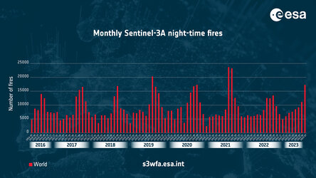
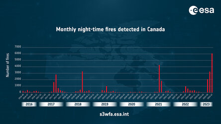
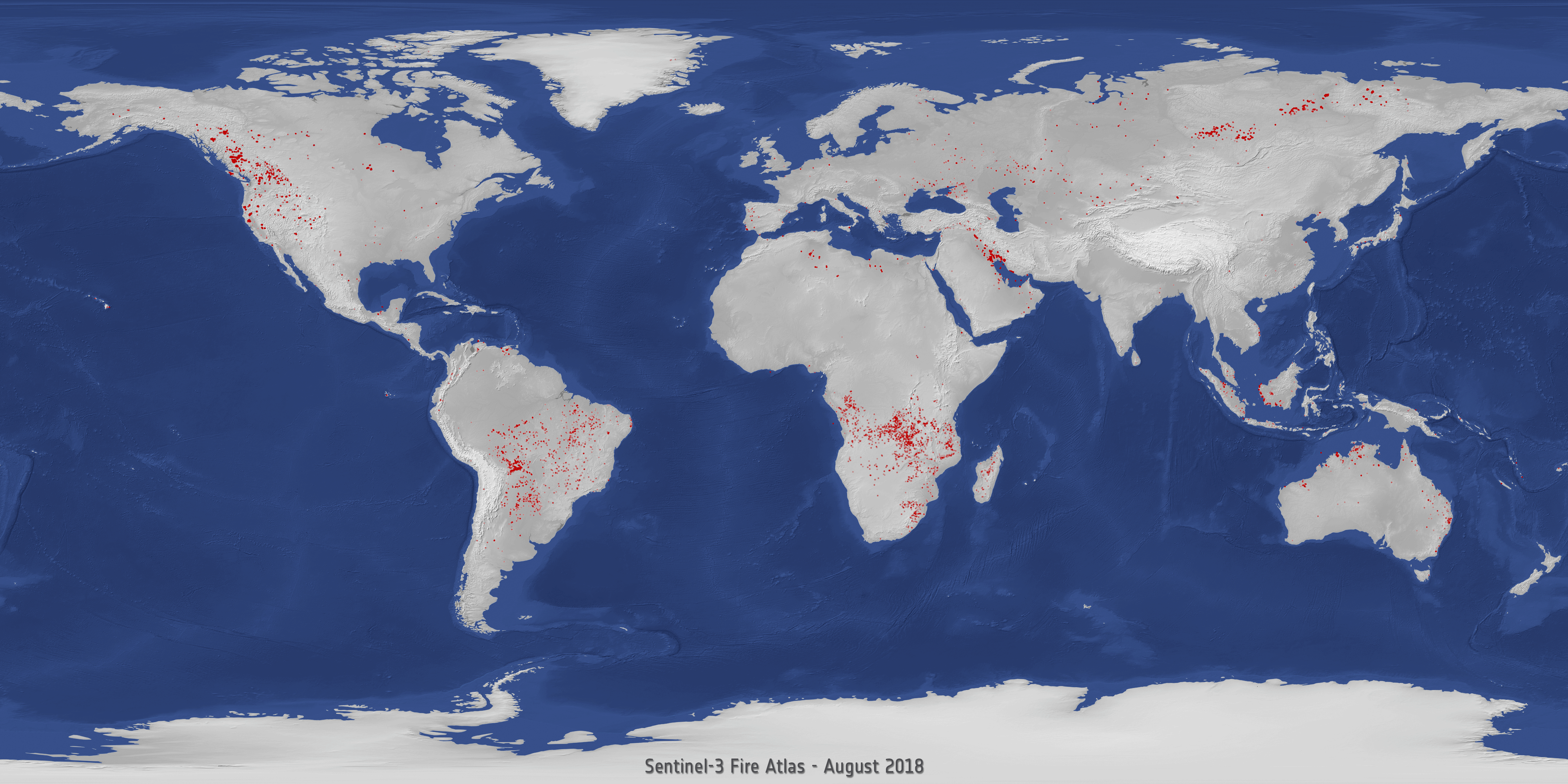
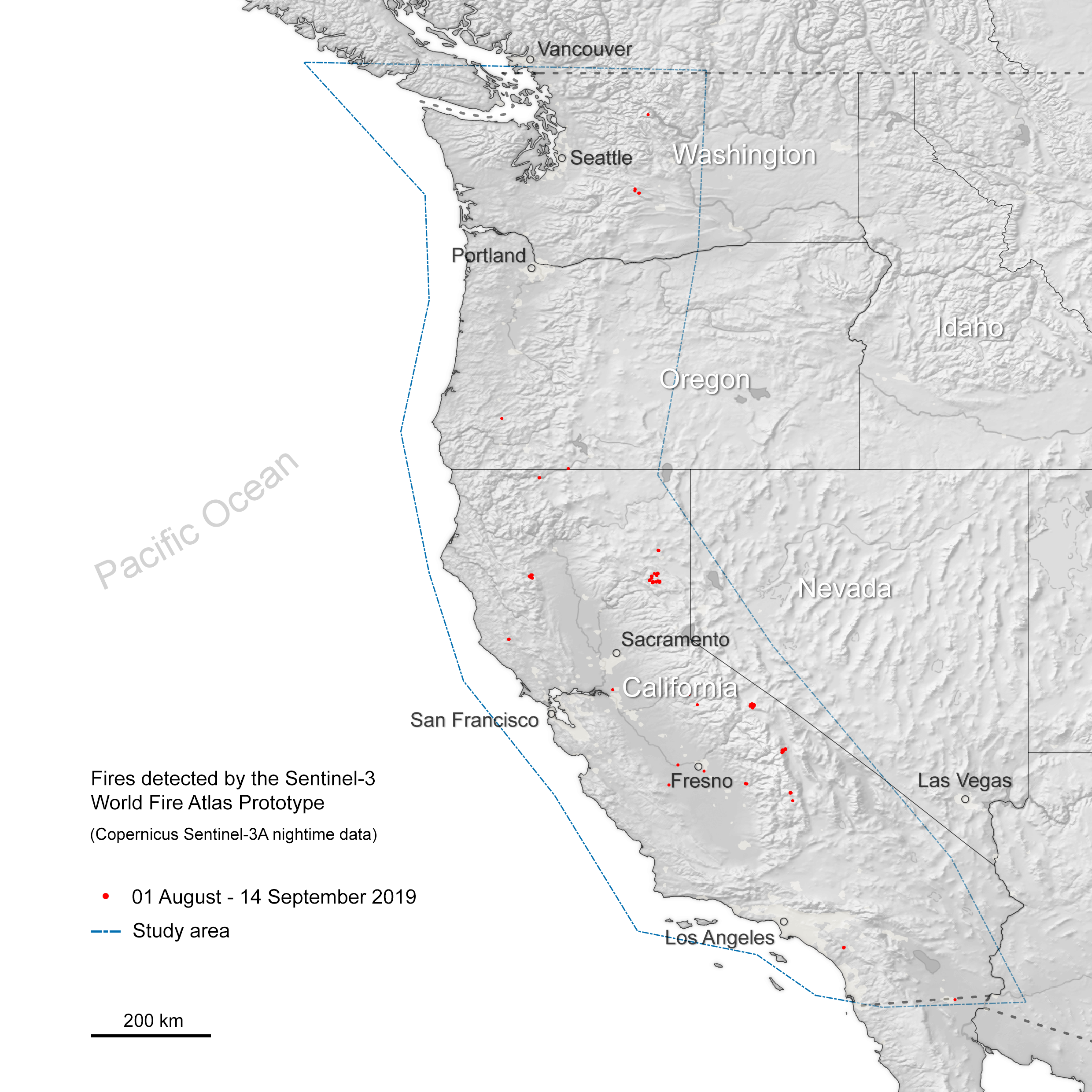
Worldwide fires from ESA’s World Fire Atlas
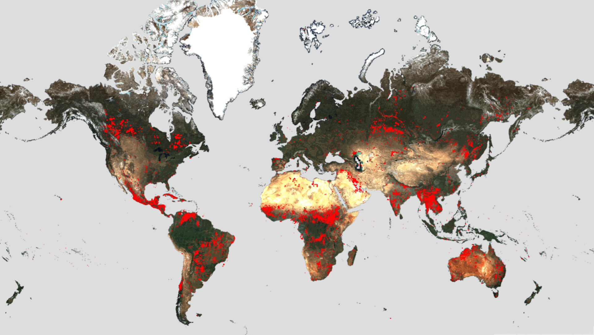
The map shows fires taking place across the globe between May 2016 and June 2023, using data from the World Fire Atlas. The atlas provides a detailed analysis of wildfires across the globe and utilised nighttime data from the Sea and Land Surface Temperature Radiometer (SLSTR) onboard the Copernicus Sentinel-3A satellite. The data have been overlaid onto ESA’s World Cover map which uses data from the Copernicus Sentinel-2 mission from 2021.
Working like a thermometer in the sky, the sensor measures thermal infrared radiation to take the temperature of Earth's land surfaces which is used to detect the fires.
Read full story: Counting wildfires across the globe